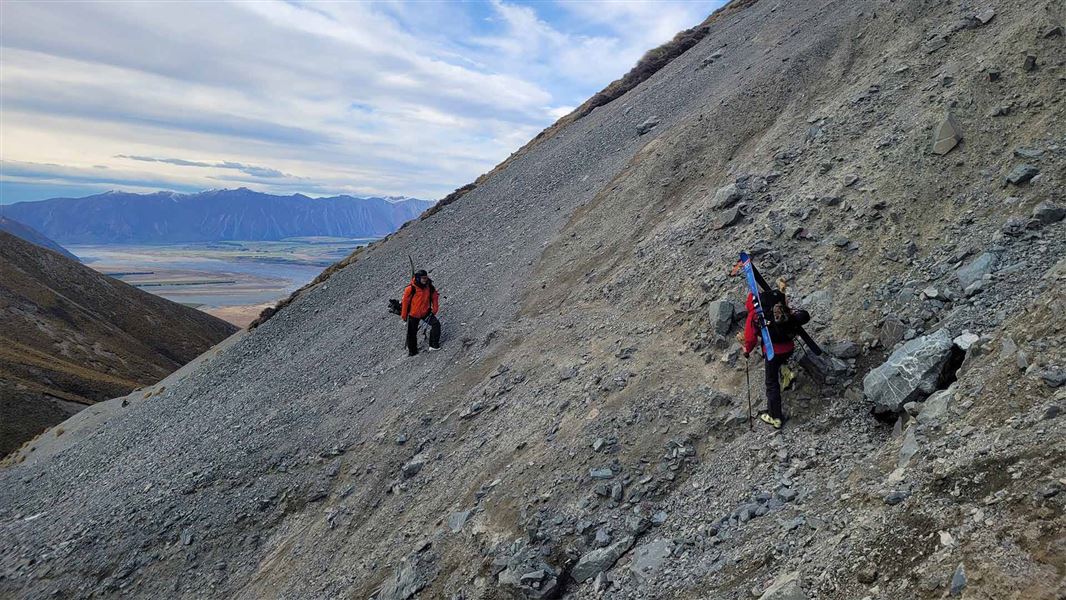
1.5 km to Mt Potts Conservation Area boundary
There is avalanche terrain in this area. Avalanches are most common from May to November.
Track from Hakatere Potts Road to Mt Potts Conservation Area boundary
DOC manages the easement track to the edge of Mt Potts Conservation Area. The track starts on Hakatere Potts Road, then climbs steadily up the hill. This is private land, so stay on the track.
The track ends at the boundary of Mt Potts Conservation Area. There is no DOC-maintained track beyond this point.
Mt Potts Conservation Area
If you plan to explore the Mt Potts Conservation Area you will need route-finding and navigation skills, and will need to manage the hazards yourself. In winter you will also need snow safety and avalanche skills. Carry a distress beacon and suitable equipment for alpine travel.
There are many avalanche-prone slopes in the area. Avalanches are most common in this area from May to November. Mt Potts is outside of the New Zealand Avalanche Advisory forecasting regions, however useful information can be found on the nearby ‘Two Thumbs’ and ‘Aoraki/Mt Cook’ forecasts.
Avalanche skills and rescue equipment are advisable if travelling above the snow line. Everyone should carry and know how to use an avalanche transceiver, probe and snow shovel. Be prepared to turn back if temperatures are increasing, rain/snow is forecast or there are signs of avalanches and snowpack instability.
Be ready for rough terrain and extreme weather
This is an alpine area. Snow is possible to low elevations and the weather can change fast. High winds (nor'wester) are common.
There is no tree cover, so you are fully exposed to the weather. Always carry warm, waterproof clothing and sun protection.
Mountain biking
Mountain biking is permitted but the route is not maintained and is rough and rocky.
Erewhon Hut
This is a private hut within the conservation area. It can be used for overnight accommodation but must be booked.
No four-wheel driving
No 4WDs or motorbikes.
From Mt Somers, follow Ashburton Gorge Road, then Hakatere Potts Road. Continue past Lake Clearwater and past the Mt Sunday Track car park. The car park for Mt Potts Easement Track is on the right-hand side of the road (travelling towards Erewhon), not far after the Mt Sunday Track car park.
The road is gravel from the junction with the Hakatere Heron Road.
Pack well for your trip
This is a remote alpine area. Pack to be self-sufficient and to be ready for extreme weather. This includes warm, waterproof clothing and a distress beacon.
Overnight and multi-day tramp gear list
Make sure you have the skills and experience
There is no marked track in Mt Potts Conservation Area. Travelling through this area requires route-finding and navigation skills, as well as the ability to identify and manage hazards.
At some times of year, you need additional winter alpine equipment and skills.
There may be avalanche danger
Avalanches usually occur in this area from May to November. There can also be avalanches outside this period, if there is still snow coverage.
If you are going into avalanche terrain, always:
- Have the relevant avalanche skills and training.
- Check the New Zealand Avalanche Advisory before you go. Mt Potts is outside of the NZAA forecasting regions, however useful information can be found on the nearby ‘Two Thumbs’ and ‘Aoraki/Mt Cook’ forecasts.
- Go with a buddy. Both of you should carry and know how to use an avalanche transceiver, a snow shovel and a probe.
Stay safe when crossing rivers
If you plan to cross unbridged rivers, know how to cross safely and be prepared for if you cannot cross.
Do not cross if the river is flooded, you cannot find safe entry and exit points or are unsure it’s safe. Turn back or wait for the river to drop. If in doubt, stay out.
Aoraki/Mount Cook National Park Visitor Centre
| Phone: | +64 3 435 1186 |
| Email: | mtcookvc@doc.govt.nz |
| Address: | 1 Larch Grove Aoraki/Mount Cook 7999 |
| Hours: | Visitor centre hours and services |
