These short walks in Lake Ōkataina Scenic Reserve are quite close together. They can easily be linked together to make up to 1-3 hours of walking.
Ngahopua Track (Twin Lakes Track)
Time: 50 min loop
Distance: 2 km
The track takes you 100 m above the twin volcanic crater lakes of Rotongata and Rotoatua, which formed about 3,500 years ago and support a variety of interesting birdlife including scaup and dabchick.
This track connects with the Anaha Track (which in turn connects to the Kepa Track) to the south and can be combined with this track for a longer walk.
Where the track skirts the cliff above the two lakes, there are high drop-offs. Stay behind barriers, keep to the track, and keep your children safe.
Getting there: Start immediately opposite the side road to the Outdoor Education Centre on Lake Ōkataina Road.
Anaha Track
Time: 60 min one way
Distance: 2.3 km
The track passes through old logging sites. It finishes 1.2 km from the start but can be walked as a loop by walking back along the road. It was named after Anaha Te Rahui, a master carver in the Rotorua District.
The track connects with the Ngahopua Track to the north and the Kepa Track to the south. It can combined with one of these tracks for a longer walk.
Getting there: Start about 100 m south of the Outdoor Education Centre on Lake Ōkataina Road.
Kepa Track
Time: 10 min one way
Distance: 425 m
The track takes walkers through clearings where evidence of past logging activity remains. The track finishes about 500 m south from the start but can be walked as a loop by walking back along the road. This track was named after Kepa Ehau, who was largely responsible for the scenic reserve status of the area.
The track connects with the Anaha Track to the north. It can be combined with the Anaha Track (which in turn connects to the Ngahopua Track) for a longer walk.
Getting there: Start from Lake Ōkataina Road, 100 m south of the Outdoor Education Centre on Lake Ōkataina Road.
Te Auheke Track (Cascades Track)
Time: 40 min loop
Distance: 1.5 km
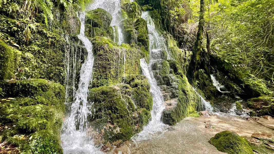
The track passes a sheer cliff face which is covered with moss and ferns. At night, thousands of glow worms can be seen. The picturesque Cascade Falls (around 10 m high) pour water over and around many rock protrusions and inspired the track’s name: Te Auheke means ‘tumbling water’.
Getting there: Start at the back of the field behind the Outdoor Education Centre.
Tarawhai Track
Time: 50 min loop
Distance: 1.3 km
A wide variety of native trees line this nature trail, including rimu, pukatea and tawa. Many are identified by name plates, making for an interesting and informative walk. A 5 m2 fenced-off area beside the southern end of this track illustrates the effects of introduced browsing animals (notably wallabies) on the native vegetation.
Getting there: Start 50 m down the side road leading to the Outdoor Education Centre on Lake Ōkataina Road.
These tracks are accessed from Lake Ōkataina Road. Turn onto Lake Ōkataina Road from SH 30 (Whakatane/ Rotorua highway) at Ruato, 22 km from Rotorua.
DOC Customer Service Centre
| Phone: | 0800 275 362 |
| Email: | rotorua@doc.govt.nz |
| Address: | Rotorua Office |
