The marine reserve was established in 2005 and is 613 hectares.
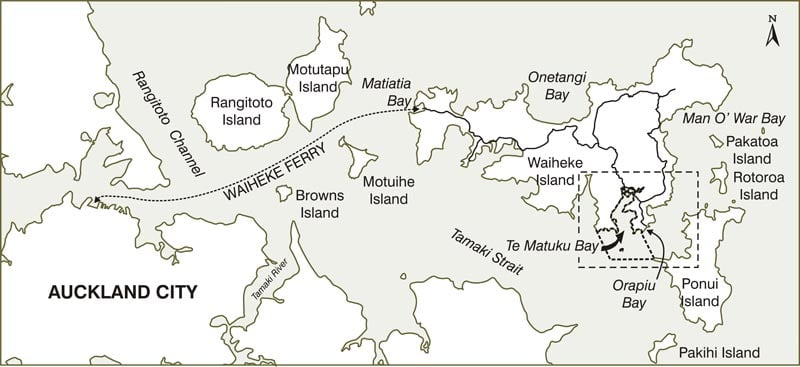
The reserve is located at the far south-east corner of Waiheke Island in the Hauraki Gulf. It extends into Tamaki Strait and can be accessed by land and sea.
By land, access is best by car - there is no public transport on this part of Waiheke Island. The drive to the reserve takes about 25 minutes from Kennedy Point (the vehicle ferry wharf) via Orapiu Road, which skirts around Te Matuku Bay.
Once in the Orapiu area, take Anzac Road which joins Nepean Ave and leads down to Otakawhe Bay where there is parking available. Note that nearby Hunterville Road begins at Orapiu Wharf and ends at Otakawhe Bay. It is more like a gravel walking track than a road. 360 Discovery run a ferry service from Auckland city to Orapui Wharf on it's way to the Coromandel.
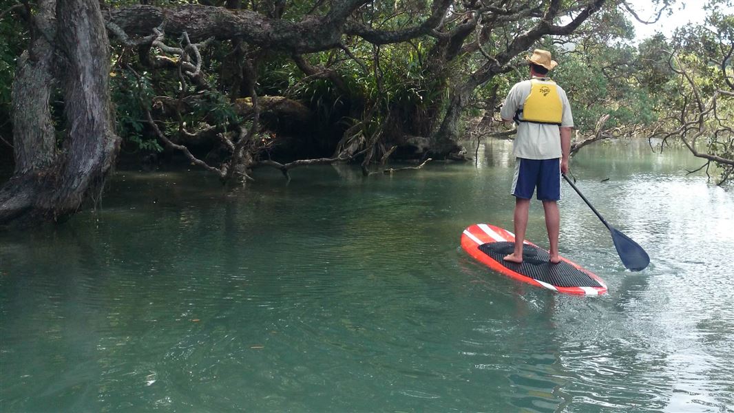
Otakawhe Bay is the eastern-most beach of the marine reserve. With easy access from the road it is the perfect place to launch kayaks, although be aware of the tidal currents that effect this bay.

Location map of Te Matuku Marine Reserve
Dogs are not allowed in the marine reserve.
Plan around tides
Reference a tide chart before visiting the reserve. Te Matuku Bay does experience tidal shifts to where areas will dry out at low tide. Mud towards the head of the bay is very soft and you can sink up to your waist.
Care for the fragile ecosystem
If you are accessing the reserve during low tide, please take extra care to avoid walking through the mudflats. Tubeworm colonies pacific oyster beds, and nesting shorebirds, such as the endangered New Zealand dotterels, call this ecosystem home and are vulnerable to human disturbances.
No fishing or collecting seafood
Fishing, collecting, or disturbing marine organisms and resources are prohibited within marine reserves. If you see people taking anything from the reserve, report the activity to 0800 DOC HOT (0800 362 468). Also report pollution, oil spills, navigation hazards and dangerous boating.
The implementation of the reserve does not affect any persons right of ownership or lawful occupation of moorings and jetties within the reserve.
Information for boaties
Navigation within the reserve is not restricted. Passage Rock is an important navigation aid and boats commonly pass between it and Te Matuku Bay through the marine reserve.
Care should be taken to avoid damaging marine life by dragging anchors.
Boaties should not allow their boats to rest on the tidal flats at low tide as this can damage fragile intertidal species, particularly the tubeworm colonies.
Total fire ban on Hauraki Gulf islands
There is a total fire ban on islands in the Hauraki Gulf. There are sometimes exceptions for Waiheke, Great Barrier, Kawau and Rakino which Auckland Council look after.
Rules for outdoor fires on Auckland Council Hauraki Gulf islands.
This marine reserve consists of:
- saltmarsh
- mangroves
- small longshore spits
- tidal creek habitats
- extensive intertidal flats.
It represents a rare continuity of conservation from freshwater to briny.
Wading birds flock to the reserve at low tide as the bay dries almost entirely exposing extensive sand and mudflats that are filled with sea snails, cockles, crabs, and worms.
As the tide rises, juvenile flounder and mullet fill the reserve feeding on the abundant invertebrates. The bay gets its name from the now-rare Australasian bittern/matuku-hūrepo. These can sometimes be seen in the adjoining scenic reserve wetland.
A notable feature of the reserve are spiny tubeworms (Pomatoceros caeruleus) colonies that are dotted over the intertidal flats. This species used to be abundant in the inner Waitemata Harbour but is now rare there.
The deepest part of the reserve is off Otakawhe Bay at the entrance to Waiheke Channel.
Strong tidal currents expose patches of shells that are colonised by sponges, anemones and soft corals. Juvenile snapper and trevally are abundant around the reefs. Rig (spotted dogfish) and flatfish are common in Te Matuku Bay.
In pre-European times Te Matuku Bay was an important food gathering and waka (canoe) landing place for Māori living in the coastal settlements and nearby mountain pā of Maunganui, the highest point on Waiheke Island. Thick shell middens in the bay are evidence of its past bounty of kaimoana (seafood).
Ngāti Paoa are tangata whenua (people of this land) and traditional kaitiaki (guardians) for Waiheke Island. Other iwi, such as Hauraki and Ngāi Tai, also have ancestral ties to this area, which is of historic, cultural and spiritual importance to these tribes.
Te Matuku Bay was Waiheke’s earliest European settlement but all that remains are the sites of the first school and the pioneer cemetery at the head of the bay.
Protect our marine reserves
- No fishing of any kind.
- Don't take or kill marine life.
- Don't remove or disturb any marine life or materials.
- Don't feed fish - it disturbs their natural behaviour.
- Take care when anchoring to avoid damaging the sea floor.
DOC Customer Service Centre
| Phone: | 0800 275 362 |
| Email: | aucklandnorthhead@doc.govt.nz |
| Address: | Maungauika / North Head Office |
DOC Customer Service Centre
| Phone: | 0800 275 362 |
| Email: | warkworth@doc.govt.nz |
| Address: | Mahurangi / Warkworth Office |
