This is a high protection area (HPA). Make sure you know what you can and can’t do in this area.
New marine protection
19 new marine protected areas are now in place in the Hauraki Gulf/Tīkapa Moana. These areas will contribute to a healthier Gulf for future generations.
Find boundaries and maps on this website and the marine mate app, ask your electronic chart provider or check signs at water entry points.
The waters around Pakatoa and Tarahiki/Shag Island are approximately three kilometres east of Waiheke and can be reached by private boat or kayak.
View a map and co-ordinates of Pakatoa and Tarahiki/Shag Island High Protection Area.
This is a High Protection Area.
Make sure you know Hauraki Gulf protection area rules and how you can help preserve this precious ecosystem.
Pakatoa is privately owned. Landing is not permitted.
Report illegal or suspicious activity
Don't take, disturb, kill or damage anything within the protection areas. It is illegal. If you see people taking anything from the reserve, report it as soon as possible.
Call 0800 4 POACHER (0800 476 224) or 0800 DOCHOT (0800 362 468).
It is an offence to pollute, litter, discharge fire arms and erect structures.
Report pests
Find-A-Pest lets you report potential pest species, including marine, plant, animal and fungal species.
If you come across something out of the ordinary, upload a picture to the app and a specialist will help identify it. If it's a biosecurity threat, this will be forwarded to Biosecurity New Zealand. If possible, take photos and record the location and name of the vessel.
Or call the Ministry for Primary Industries' Pest and Diseases hotline on 0800 80 99 66.
Prevent pests from spreading
Minimise the spread of pests on land and in water by thoroughly checking and cleaning your boat and gear. Keep your favourite spots pest-free for future generations by following these guidelines:
- clean your hull out of the water before you leave, including the propeller and anchor - see guidelines for hull cleaning
- clean all recreational and boating gear
- if leaving Auckland, check the marine pests website for biodiversity rules for other regions.
Check the marine pests website for more marine biosecurity information.
Pakatoa, Tarahiki/Shag Island and nearby Kahakaha/Frenchman’s Cap are all classified as a marine Significant Ecological Area in the Auckland Unitary Plan.
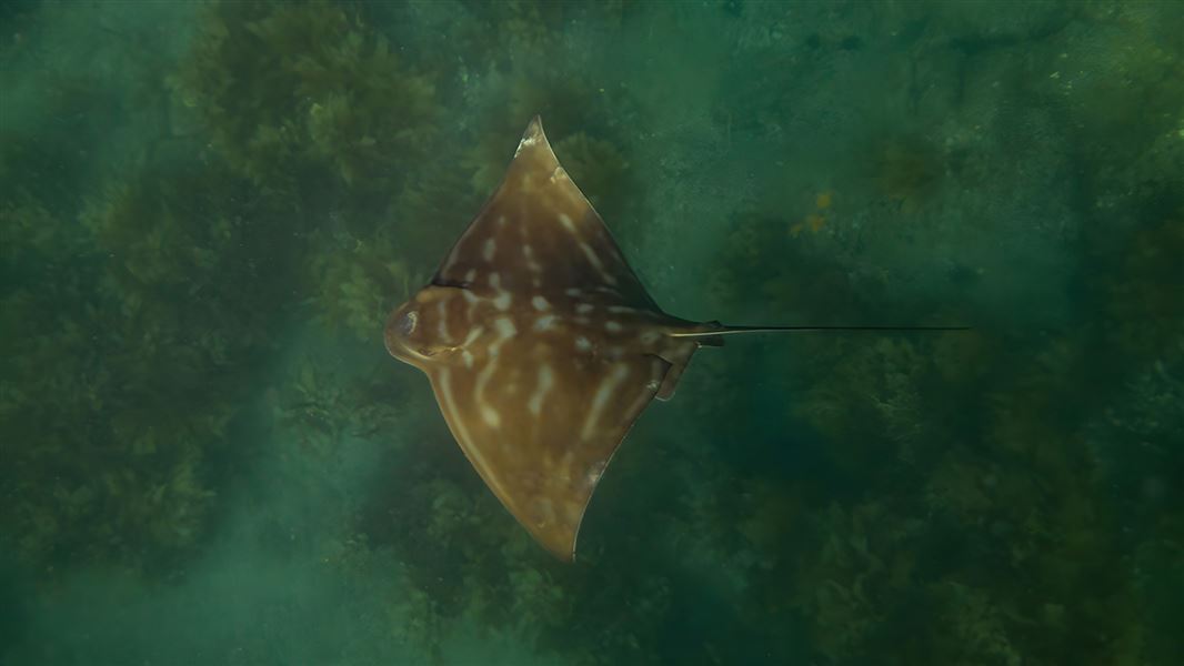
Pakatoa and Tarahiki Islands and the sea and seafloor between them is home to many species of sponge, horse mussels/hururoa and scallops/tīpa. Snapper/tāmure are also found here
To the west of Pakatoa Island, these waters are home to important dog cockle beds that act as filters and ’red stones’, (or rhodolith, a kind of coralline red algae) beds that provide shelter and food.
Six hectare Tarakihi/Shag Island is an important breeding site for spotted shags/kawau tikitiki. Their waste is an important part of the food chain because it feeds the smallest organisms, including zooplankton and phytoplankton.
The Hauraki Gulf Marine Park/Tīkapa Moana/Te Moananui-ā-Toi has a rich history of human settlement. It includes the earliest places settled by Māori.
The area has supported the physical and spiritual wellbeing of mana whenua for centuries. Mana whenua use tikanga/customs that care for and protect the environment when collecting kaimoana/seafood. Mana whenua is the iwi or hapū that has customary authority in an area.
There is limited information available about Māori occupation on Pakatoa Island, but there have been five archaeological sites.
Briefly known as Bell’s Island, Pakatoa was used as a prison in the early 1900s. It then became a Salvation Army managed Alcohol and Drug rehabilitation facility for women. In 1943 it became a recreation centre for elderly people.
In the 1960s Pakatoa became a tourist resort with chalets, swimming pools and a nine-hole golf course making it a popular holiday destination for Aucklanders in the 1970s.
The island is p one of the few privately owned islands in the Hauraki Gulf.
Protection areas
These protection areas began in 2025. They were initiated from the Government response to the Sea Change – Tai Timu Tai Pari Hauraki Gulf Marine Spatial Plan. Sea Change was developed collaboratively by tangata whenua, environmental groups, and the fishing, aquaculture and agriculture sectors of the Hauraki Gulf between 2013 to 2017.
Help high protection areas
- No recreational or commercial fishing.
- No dumping or discharge of waste, sewage or litter.
- Take no more than a handful of shell, sand or driftwood.
- Anchoring is allowed.
- Certain Māori customary practices are allowed.
Some protection areas have exceptions to these rules.
DOC Customer Service Centre
| Phone: | 0800 275 362 |
| Email: | info@doc.govt.nz |
If you see any illegal or suspicious activity, contact the DOC emergency hotline 0800 DOC HOT (0800 362 468).