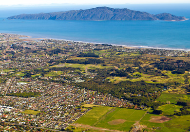
Waikanae and Kapiti Island
Image: Chris Osborne | Creative Commons
Status: good
Kapiti Marine Reserve is divided by Kapiti Island, an undeveloped nature reserve.
On the mainland, the marine reserve ends at the Waikanae Estuary Scientific Reserve, a protected area that includes the lagoons, marshes and tidal flats at the mouth of the river. The land to the north of the marine reserve along the Kapiti coast is forested, farmed or developed for housing.
Strong ocean currents move through the marine reserve. It is not known how much the marine reserve is affected by urban development or other activities on the Kapiti Coast or beyond.
Trend: undetermined
Changes on the land around the marine reserve (including urban development) in the last 5 years cannot be quantified, so the trend is undetermined. Some documented changes in land use are summarised below.
Population
The population of the Kapiti Coast increased from estimates of 50,400 on 30 June 2012 to 52,700 on 30 June 2017.
Building
The number of building consents for new buildings granted by the Kapiti Coast District Council rose from 177 in 2013 to 309 in 2017.
Roading
A large road-building project, the Wellington Northern Corridor, has been ongoing on the Kapiti Coast in the last 5 years. Mitigation of the environmental effects of the construction work is specified in the project’s resource consents.
Read more on NZTA website: Wellington Northern Corridor, Mackays to Pekapeka.

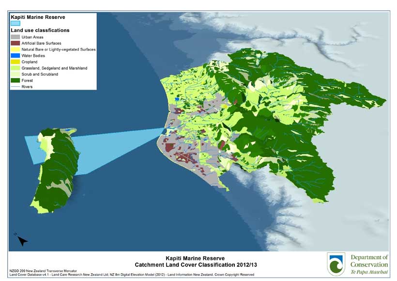
Kapiti Marine Reserve Catchment land cover classification 2012/13. View larger (JPG, 584K)
This map shows the land use of the catchment area of the marine reserve. It was mapped using remote sensing software from Landsat satellite imagery and verified with aerial imagery. The land use classes were a simplified version of the classes used in the Land Cover Database developed by Landcare Research.