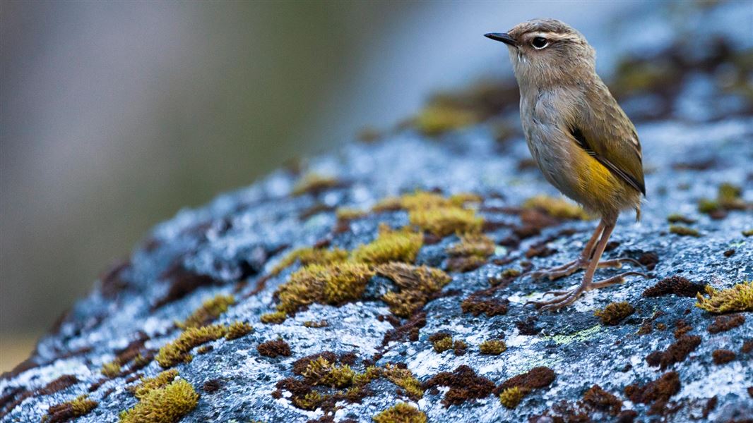
A diver and an octopus, Wellington/Kāpiti
Image: DOC

Introduction

Eight research projects at Kāpiti Marine Reserve are helping us to understand our oceans. They’re supported by iwi, communities and scientists.

Kāpiti Marine Reserve is unique. It’s full of species usually found further north or south and has many distinct habitat types. Two major sea currents meet here, supporting a wide range of species and habitats.

This helps us understand how changes can affect many types of ocean wildlife and environments at once and gain insights into how to best protect our oceans.

What we’re discovering at this site

We’re studying birds, how wildlife interacts as well as water, shore and seabed health to better understand our oceans:

Researching and protecting important species

Understanding ocean environments and how to protect them

Teachers can also introduce students to what’s underwater here with a virtual fieldtrip by LEARNZ, supported by DOC. Students can discover how to survey marine wildlife, and what we can learn from this to better protect it.


Researching and protecting important species

Protections for little penguins/kororā

As land is developed along the coast, little blue penguins/kororā are put at risk. People, roads, and pets like cats and dogs are threatening their survival.

When breeding, these penguins are at their most vulnerable. So, we’re supporting the Kāpiti Coast Biodiversity Project to survey little blue penguins from Waikanae Beach to Ōtaki Beach during the breeding season, from August to December.

This long-running project works with local residents to provide the penguins safe places to raise their chicks and counts how many kororā are returning to breed every year.

Understanding the ocean’s health by studying shags

By studying shags on Kāpiti Island, Mana Island, and the mainland, we can learn how shags respond to different levels of protection. We’re also working to find out how potential risks to them, like beach driving and predators, might affect their breeding on Kāpiti Beach.

Their presence tells us a lot about the health of their environment. This is because they’re a good indicator of land and ocean health. So, by monitoring changes in their populations, we can understand the changes in the environment.

Working with a wide range of groups, we are supporting bird counts. We’re surveying shag colonies on Mana Island and at Waikanae Estuary and doing boat-based surveys of shags at Kāpiti and Mana Islands, and along the main Kāpiti beaches.

Studying what affects fish population

We’re supporting a project to help find out if changes in fishing and predation affect the number and size of fish in and around the reserve. To do this, we’re assessing over 30 years of diver survey data and recently tagged fish using statistical models. 

Marine predators that eat fish can affect the species these fish prey on. Recreational fishing also targets larger fish leaving only smaller fish. Fishing is not allowed in marine reserves, so we hope to use the fish populations here to find if there are difference in other areas.

We’re working with Fisheries New Zealand, local fishers, NIWA, Tindale Marine Research Charitable Trust, and Victoria University of Wellington on this project. Tindale Marine Research Charitable Trust are tagging fish to gather more information about the distribution of species and improve the accuracy of the model.

In the autumn of 2019, we tagged 100 fish on two trips to Kāpiti. We are encouraging fishers to report any of the tagged fish they catch and to learn how to tag fish themselves (see below). You can also contact the trust directly if you’re interested in tagging fish in your area.

To help us with the project, if you catch a tagged fish, we ask that you:

You can keep the fish or let it go. The trust will notify you if a fish you tagged is re-caught. All tagging data is recorded by the trust and made available to DOC.

Understanding ocean environments and how to protect them

We’re working to understand how changes impact our oceans and the wildlife found in them through research projects. These include examining the types of habitats here, monitioring water quality and surveying plants and animals.

Many different species depend on each of the habitat types in the area. But some are more easily damaged than others. For example, rocky reefs are vulnerable to changes in land use and water quality. while delicate sponge beds can be destroyed by anchoring.

Habitats at Kāpiti include:

  • rocky reefs
  • soft seabed such as sand and mud
  • biogenic reefs (like sponges)
  • the coastline from high to low tide (intertidal zone)
  • below the tides (subtidal zone)

Studying underwater habitats

Under the waves around Kāpiti Island are a huge variety of seabed habitats. We are working with NIWA, Victoria University of Wellington and LINZ to map the seafloor surrounding Kāpiti Island.

Mapping the seafloor shows us what habitats are present where. Detailed maps will help us promote awareness of the rich diversity of the seafloor here and the wildlife it supports. It will also help us better manage the area and make sure that we are protecting the right areas.

Habitat maps will also help us better understand what causes the high biodiversity of this marine reserve. They can also be used to determine how effective the reserve is at protecting a habitat type, and if they are being affected by climate change.

Understanding risks and improving recreation through water quality

From spring 2020 a specialised buoy will collect real-time data about the water quality between Kāpiti Island and the mainland. This data will help us learn about the island’s unique conditions and detect changes that may affect wildlife and coastal health.

We’ll also be able to compare the island’s water quality with that measured by a sister buoy in Wellington Harbour. This will help us to understand the effects of land or city run-off on the ocean water.

Understanding how water quality changes will benefit both wildlife and people. The data will be available to everyone on the Greater Wellington Regional Council website. Iwi, students, divers, fishers and the wider community can all use it.

It measures:

  • currents and waves,
  • salt levels
  • chemical composition (oxygen, chlorophyll, and pH balances)
  • temperature
  • sediment
  • wind direction and speed

We are helping install this by working with NIWA, Greater Wellington Regional Council (GWRC). We’re also receiving input from Te Ātiawa ki Whakarongotai and Ngāti Toa Rangatira.

As part of the project, we are also comparing the buoy measurements to satellite images to develop methods to detect water quality from space.

View water quality data on GWRC's website

Creating a baseline for healthy rocky shores

The rocky shores around Wellington/Kāpiti are important habitats. They provide homes and food for many species and help to regulate our climate. By studying the isolated rocky shores around Wellington, we can set a baseline for reef health.

Rocky shores are easily affected by land pollution and other changes. This baseline will help us to know when human impacts are damaging reefs.

We supported Greater Wellington Regional Council to survey the species found on the shore. With Kāpiti Island Eco Experience and Kāpiti Island Nature Tours, they surveyed sites within and near Kāpiti Marine Reserve and on Mana Island.

The surveys showed that they were healthy and that there were no differences between the shore within the marine reserve and those outside. This is not surprising given that these remote islands aren’t very impacted by humans.

Read a summary of Kāpiti and Mana Island Rocky Shore 2019 survey (PDF, 2,027K)
Read the full Kāpiti and Mana Island Rocky Shore 2019 survey report

Using tools to better understand and protect habitats

Understanding threats and risks to a marine reserve is complex. There are many factors that can contribute to a healthy reserve and damage it.

The Marine Habitat Assessment Decision Support (MarHADS) tool can help us to find out and understand more about the threats facing our marine environment. It can also help us understand and manage threats, find out which areas are most at risk and where help is needed most.

Using the tool, we’re bringing together existing knowledge and new survey data. We’re working with local experts and community groups to put their existing knowledge in to the tool. This is helping us to know what we should focus on in the survey results.

The MarHADS tool was developed by NIWA and regional councils provides a nationally consistent method to help us determine what the key risks to biodiversity are within the marine reserve.

Contact

For more information email marine@doc.govt.nz

Back to top