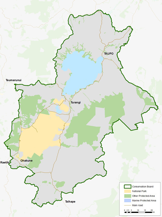
The Board's district encompasses approximately 818,700 ha of land extending from the Wahianoa River and Lake Moawhango to the south, and up to Atiamuri and Whakamaru in the north. The district also stretches from Erua Forest and SH4 to the west, across to Ngaruroro River in the east and abuts the Kaweka Forest Park boundary.
Approximately 221,000 ha of public conservation land is administered by DOC which represents almost 27% of the total area of the board's district.
Within the board's district is the volcanic landscape of Tongariro National Park; the conservation areas of Kaimanawa, Tongariro, Erua and Rangataua forests; and the rivers, waters and reserves of Lake Taupō.
In addition to hosting a variety of ecological features, indigenous flora and fauna and a world renown sport fishery, the district provides accessible opportunities for a range of recreation activities including tramping, cycling, hunting, fishing, sightseeing and skiing. These attractions have led to high visitor numbers and concessionaires with Tongariro National Park hosting more visitors each year than any other in New Zealand and Huka Falls claiming fame as New Zealand's most visited natural attraction.
