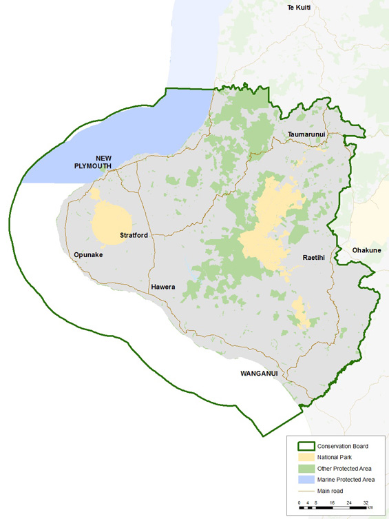
The Board’s area of responsibility covers DOC's boundaries for the Whanganui and Taranaki areas within the greater Central North Island region. It encompasses some 15,000 sq km of land extending from the Mōkau River in the north to the Turakina River in the south and inland to Ohura and Taumarunui. Approximately 298,000 ha of public conservation land is administered by the DOC which represents almost 20% of the total area of the board’s district.
In addition to a number of scenic, historic and recreational reserves, the district includes both the Egmont National Park and its associated array of recreation opportunities, and the Whanganui National Park with its unique history and strong cultural connections.
The coastal boundary that extends along the Board’s district includes the Tapuae and Paraninihi marine reserves as well as the long established Nga Motu/Sugar Loaf Islands Protected Area.
Volcanoes, wild and scenic rivers, huge tracts of forest, rugged mountain ranges and a dynamic coastline provide for a great diversity of landscapes, habitats, plants and animals.
