This track is part of Te Araroa Trail.
The track can be walked from either direction. Walking south from Scotts Road is easiest for the steepest gradient is then downhill. If going from south to north, an extra 1 hour 30 minutes is recommended due to the uphill climb from the Tokomaru River in the latter part of the walk.
The following track description applies to the walk when undertaken from north to south.
A stile crosses the fence and an information sign is located just before the bridge over the Kahuterawa Stream.
- DOC Boundary 1 hour 30 minutes
- Tokomaru River 3 hours
- Burtton’s Whare site 3 hours 30 minutes
- Mangahao Road Carpark 6 hours
The walk commences following the metalled forestry road alongside the Kahuterawa Stream.
After around 40 minutes there is an open clearing where the forest roads fork. The trail is clearly marked taking the right road and passing remains of former farm buildings and yards.
An hour from the start, a second locked gate is passed, the track then climbs steadily and the plantation forest gradually changes to regrowth native bush.
Following along the forest park boundary, views of Kaihinau, the Tokomaru Gorge and the Manawatu Plain are visible to the West. The gradient increases until the signpost and stile marking entry into Tararua Forest Park are reached. This is where the DOC-managed track begins.
The track then descends from 500 metres above sea level down to No 1 Stream at 200 metres above sea level taking about an hour and is clearly marked with DOC orange triangles.
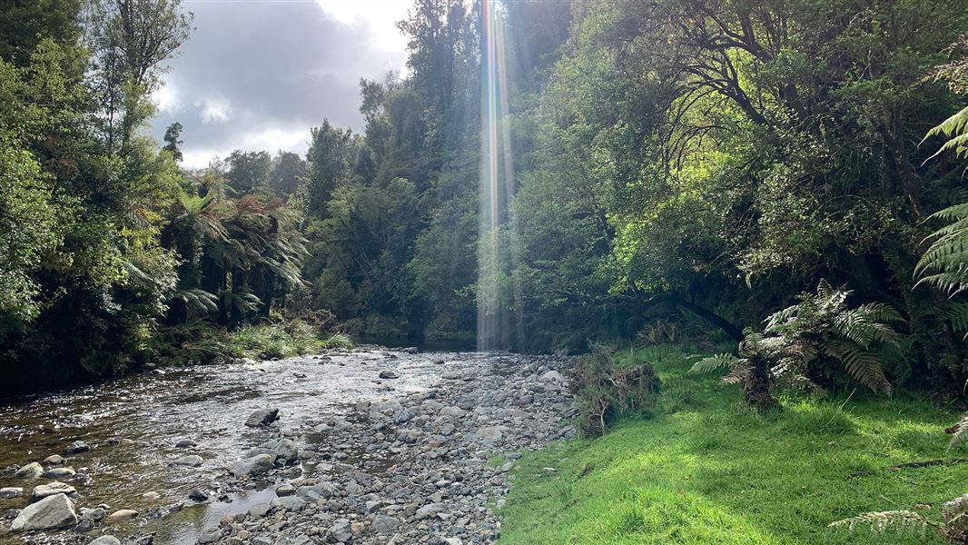
Most of the year the creek is low and easily crossed but as with all back country rivers and streams, can be hazardous and requires care during periods of rain and high water.
The track crosses the No 1 stream and then follows the eastern side of the Tokomaru River. Previously the track crossed the Tokomaru River twice, so this may still be shown on your map – avoid crossing the river and instead use the newly re-routed track.
The track re-enters the forest park – this is the start of the original Burtton’s Track. Five minutes further on the former Burtton’s Whare site is reached. Considered as midway when going south it is an ideal site for a lunch break.
From here the track is the historical trail built by Jim Burtton almost 100 years ago. It follows up the Tokomaru River.
After another 1 hour 30 minutes a further stile is crossed as the track passes out of Tararua Forest Park and a cairn commemorating the opening of the trail by the Prime Minister in February 2006 can be seen.
The final hour of walk, 3.2 km is along the former Tokomaru Valley Road. This road is closed to unauthorised traffic but is sometimes used by registered 4WD vehicles.
The DOC track ends at the carpark just off the Mangahao Road 7.7 km from the Mangahao Power Station. From here you have the option of arranging transport, walking down Mangahao Road towards Shannon, or continuing up the road towards the dams to the Mangahao-Makahika Track.
Mountain biking
Burtton's Track is suitable for advanced riders. The track is best ridden in dry conditions from North to South and includes some river crossings. It's not recommended in wet conditions.
The best option is to ride from Kahuterawa Rd or Scott's Rd to Gordon Kear Forest. It will take around 30 mins to ride through the forestry to the DOC boundary. Over the stile, a descent ending in a river crossing begins.
From here on, expect some pushing/carrying on occasions until you get through to the forestry sections on Tokomaru Valley Road. Once there, keep on the gravel road until it meets Mangahao Road. Turn right to head uphill to the top of the saddle, then head downhill for around 5 km to Mangahao Power station and village – beware of cars in this section.
This track is a shared-use path and is part of the Te Araroa walkway. All riders must give way to walkers and show respect to other track users.
From Palmerston North the track can be accessed from Scotts Road leading off Tennant Drive (SH57) 15 km south after crossing the Manawatu River at Palmerston North. The track starts at the entrance to Gordon Kear Forest. There is a carpark on Scotts Road.
Vehicles may not be parked on the forest road where there is a locked gate at the track. Any vehicles parked on the forest road risk being towed away or damaged.
Expect a shared-use, backcountry track
The track is used by walkers and bikers. It is part of Te Araroa. Please respect other track users.
There can be logging trucks anywhere on Scotts Road at any time, weekdays and weekends.
This is a typical backcountry tramping track. It is rough and uneven, and you can expect mud in places and to be scrambling up and down tree roots.
Take care when crossing unbridged streams
This track has unbridged stream crossings. These can rise rapidly and flood during/after rain, making them unsafe to cross.
Do not cross if the stream is flooded, you cannot find safe entry and exit points, or are unsure it’s safe. Turn back or wait for the river to drop. If in doubt, stay out.
Weather
Weather in the Tararua Forest Park can change rapidly. Cold and wet weather is common at any time of year.
Check the forecast: NIWA Weather: Tararua Forest Park. Always carry a waterproof raincoat and warm layers.
Pack well, this is a remote track
There is no cell phone coverage, so take extra clothing, food and first aid gear.
Due to the remote nature of the track, walkers and riders should be competent with navigation and basic bushcraft. Study a topographic map to get a good idea of the route. Take a compass and map, or GPS with you.
Know the rules for fires and firearms
Fires are not permitted at any time. No firearms are allowed on private land.
Stay safe in the outdoors
- Choose the right trip for you. Learn about the route and make sure you have the skills for it.
- Understand the weather. Check weather forecasts.
- Pack warm clothes and extra food. Check gear lists.
- Share your plans and take ways to get help. Leave your intentions with a trusted contact and take a distress beacon.
- Take care of yourself and each other.
Wellington/Kapiti information
| Phone: | +64 3 546 9339 |
| Email: | nelsonvc@doc.govt.nz |
| About: | Whakatū/Nelson visitor services provide information for this area |