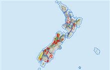
Travers - Nelson Lakes National Park
Located in Nelson Lakes hunting in the Nelson/Tasman region
|
Introduction
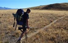
Red deer are in moderate numbers throughout the Travers area, frequenting the open tops and river flats more in the early morning and late evening. Chamois may also be encountered on the tops.Species
- Chamois
- Deer - Red
Permit requirements
This hunting area is covered by an 'open area permit' – get it online or from a DOC office.
Seasonal restrictions
Some areas closed 22 December to 9 February.
Dog access
About this hunting block
General information
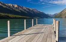
The Travers River runs in to the southern end of Lake Rotoiti and has a track running the length of it which is part of the popular Travers-Sabine Circuit.
Vegetation is mainly beech forest with the lower slopes dominated by red beech, silver beech, and kanuka at sites with poor drainage, and upper slopes by silver and mountain beech grading to pure mountain beech at tree line.
This beech forest ecosystem is transitional from Lake Rotoiti/Travers Valley which has the drier beech forests of western Marlborough through to Lake Rotoroa and the Matakitaki where the mixed beech-podocarp forests of North Westland become more prevalent.
The park is steep and rugged and can experience severe weather conditions in any season. Heavy rain will flood rivers that can become dangerous to the unwary. Care needs to be taken at all times.
Red deer are in moderate numbers throughout the area, frequenting the open tops and river flats more in the early morning and late evening.
Chamois may also be encountered on the tops.
Access
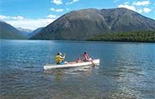
Access is generally gained via the lakeside track from the road end at Kerr Bay or boating up Lake Rotoiti to Lakehead Hut or Coldwater jetties.
Landholders
All in Nelson Lakes National Park.
Map information
NZTopo50 BS24
Dogs
Dogs are not allowed in Nelson Lakes National Park.
Hut information
Additional information
Wasps are usually in high numbers from mid to late summer so hunters need to be prepared for this hazard, especially if allergic to stings.
This valley and its side valleys, has high usage by trampers especially during the summer months so adhere to permit conditions re hunting distance from tracks.
Good trout fishing is available in Lake Rotoiti and the Travers River (Fish & Game licence required - see Fish & Game Council).
Periodic closures
The following areas close between sunset 22 December and sunrise 9 February: Nelson Lakes National Park (500 m adjoining the shores of lakes Rotoiti and Rotoroa, and upstream to Travers swing bridge, Sabine gorge bridge and Bull Creek).
Closed areas (no recreational hunting allowed)
Rotoiti Nature Recovery Project area (part of Nelson Lakes National Park): on the western side of the St Arnaud Range from Lakehead Hut through to SH63, and from St Arnaud village west to the Buller River and south to include the front face of Mount Robert.
About Teetotal sighting-in range
Teetotal sighting-in range is located off Teetotal Road in the Teetotal Recreation Area approximately 3.3km northwest of St. Arnaud.
Hunters can safely check their rifle sightings at the Teetotal sighting-in range facility before heading into nearby parks and conservation land to hunt.
To use the sighting-in range you must have a Teetotal sighting-in range permit, or be under the supervision of a Range Officer. This is a legal requirement under the Arms Act 1983 from 1 July 2023.
Contacts
| Rotoiti / Nelson Lakes Visitor Centre | |
| Phone: | +64 3 521 1806 |
| Email: | nelsonlakesvc@doc.govt.nz |
| Address: |
View Road St Arnaud |
| Postal Address: |
PO Box 55 St Arnaud 7053 |
| Full office details | |
| Whakatū / Nelson Visitor Centre | |
| Phone: | +64 3 546 9339 |
| Fax: | +64 4 471 1117 |
| Email: | nelsonvc@doc.govt.nz |
| Address: |
Millers Acre/Taha o te Awa 1/37 Halifax Street Nelson 7010 |
| Postal Address: |
Private Bag 5 Nelson 7042 |
| Full office details | |
| Rotoiti/Nelson Lakes Visitor Centre | |
|---|---|
| Phone | +64 3 521 1806 |
| nelsonlakesvc@doc.govt.nz | |
| Address | View Road St Arnaud 7072 |
| Hours | See visitor centre hours |