Oteake Conservation Park tramping tracks
Located in Oteake Conservation Park in the Otago region
|
Introduction
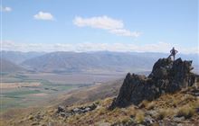
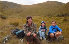
Oteake Conservation Park has a range of tramping and mountain biking tracks to explore.Walking and tramping
Advanced: Tramping trackOther activities
- Horse riding
Dog access
The tracks listed here are suitable for both mountain biking and tramping and horse riding. The exception is the Little Kyeburn Track which is not suitable for mountain biking. For more tracks in the area see the Oteake Conservation Park brochure.
Otamatapaio Track
Distance: 15 km (from 2WD carpark)
Time: 4-5 hr
Turn off SH83 onto Backyards Rd. Follow this gravel road for 2 km to the beginning of the 4WD road. Parking for 2WD vehicles is here. For 4WD vehicles continue another 5 km to the final carpark. From here, walk along this marked route for 7.5 km to the conservation boundary and a further 2.5 km to Otamatapaio Hut (10 km total from top carpark). The route follows an old farm track along the river for most of the way. River crossing required.
No dogs: Dogs are not allowed on this track as it is primarily an easement across private farmland.
Dog Gully Route
Distance: 5 km
Time: 2 hr
From the final Otamatapaio track 4WD carpark, walk 6 km along the Otamatapaio track till you reach the Dog Gully Track junction on the right. Follow Dog Gully Track for another 5 km to the conservation boundary. This is a marked route.
Mutton Creek Track
Distance: 6 km
Time: 3 hr
Links the lower sections of the West and East Manuherikia Tracks. A shorter loop option for cyclists and trampers, this is a rough track with a steep climb at both ends.
Saddle Ridge Track
Distance: 7 km
A rough track and steep climb that links the upper West and East Manuherikia Tracks with spectacular views of Aoraki Mount Cook.
Berwen Track
Distance: 5 km
Time: 1.5 - 2 hr
The tracks crosses private farmland and links the East Manuherikia Track with the Hawkdun Range.
Homestead Track
Distance: 1.5 km
Time: 45 min
This pleasant short walk follows an old water race and starts at the Homestead campsite.
Mt Ida Water Race Track
Distance: 18 km
Time: 4 - 5 hr
Well formed track with a gentle gradient that is great for the family. The track offers great views of the St Bathans Valley and opportunity for shorter loops. The track can be accessed from three 4WD tracks: Shepherds Hut Creek Track, Hut Creek and Pierces Gorge.
Mountain bike with the family. A track with a gentle gradient with oportunites for a shorter loop.
Little Kyeburn Track
Distance: 5 km
Time: 2 hr
Popular tramping track to Buster Diggings (600 m climb) that travels up the Kyeburn Stream through remnant totara and native shrubland and up to the spectacular Buster Diggings and photographic Buster Hut. A great trip in summer, view the scenic waterfall and swim in the rock pools. From the Oteake Conservation Park entrance, travel along the flats to the start of the gorge and marked trail. Not suitable for mountain biking.
There are several access points to Oteake Conservation Park on both the Otago and Canterbury sides. There are car parks at Hawkdun Runs Road, Home Hills Run Road, Mt Buster Road, Falls Dam and Broken Hut Road near Omarama. See details about access to individual tracks in the descriptions.
Several routes cross private land on registered easements. Respect this and keep to the formed tracks.
Weather: Oteake is subject to weather extremes. Take clothing for all weather. Avalanche can occur from May to November. See Be avalanche alert.
Dog access: Dogs are not allowed on Otamatapaio Track. You may take your dog on a leash on any other track in Oteake Conservation Park.
River crossings: Be aware of recent weather conditions in the catchment headwaters.
Fire: Fire restrictions apply to all conservation land. Check with the local information centres or DOC offices for the current fire status.
Communications: Mobile coverage is not reliable in the park. Satellite phones, mountain radios or personal locator beacons increase personal safety.
Topographical maps are essential for all backcountry trips.
Stay safe in the outdoors
- Choose the right trip for you. Learn about the route and make sure you have the skills for it.
- Understand the weather. Check weather forecasts.
- Pack warm clothes and extra food. Check gear lists.
- Share your plans and take ways to get help. Share directly or use the Outdoor Intentions form or Plan My Walk. Take a distress beacon.
- Take care of yourself and each other.
Contacts
| Te Manahuna / Twizel Office | |
| Phone: | 0800 275 362 |
| Fax: | +64 4 471 1117 |
| Email: | info@doc.govt.nz |
| Address: |
15 Wairepo Road Twizel 7901 |
| Postal Address: |
Private Bag 951 Twizel 7944 |
| Full office details | |