
Map and boundaries
Introduction
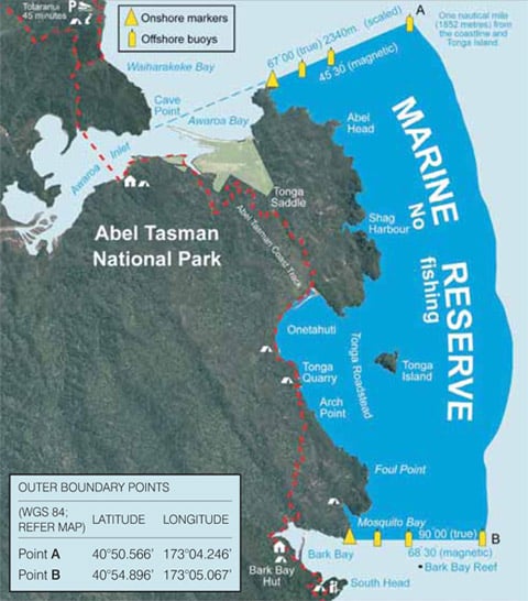
Map of the location and boundaries of the Tonga Island Marine Reserve.On this page:
Interactive map
GPS points and boundaries
Tonga Island Marine Reserve map and boundaries (PDF, 128K)
Boundaries
Tonga Island Marine Reserve covers an area of 1835 hectares, extending one nautical mile (1852m) offshore from the mean high water mark of Tonga Island, and the coast between Awaroa Head and the headland separating Bark Bay and Mosquito Bay.
GPS points (WGS 84)
40° 50.566' S, 173° 04.246' E
40° 54.896' S, 173° 05.067' E