Environment classifications
Introduction
Explore how our natural environments are classified.Classifications of New Zealand's land, freshwater and marine environments describe selected features within those environments. These can support biodiversity conservation and management efforts.
There are two classification systems to help understand New Zealand’s natural environments:
- the Land Cover Database (LCDB) identifies land cover; and
- the Land Environments of New Zealand (LENZ) uses climate, landform and soil factors that are considered likely to influence animal or plant species.
Land Resource Information Systems (LRIS)
The Land Resource Information System includes the New Zealand Land Resource Inventory (NZLRI), the National Soils Database (NSD) and information on Fundamental Soil Layers (FSL).
Ecological regions and districts of New Zealand 1987
The classification of ecological regions and districts is explained in W.M. McEwen (1987). Ecological regions and districts of New Zealand. 3rd ed. Wellington: Department of Conservation. Biological Resources Centre Publication No. 5. This publication is available in many New Zealand libraries. Ecological region and district boundaries are shown on the DOC's spatial information map service.
Terrestrial Ecoregions of the World
The National Geographic Society and WWF classify the world into terrestrial ecoregions. These classifications are based on shared ecological features, climate and plant and animal communities. The background, special features and threats facing biodiversity in each ecoregion are also described.
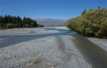
River environment classification
A GIS-based classification of New Zealand's rivers as a tool for ecosystem-based resource management. Download as a ZIP file from NIWA.
National Climate Database
The National Climate Database is provided by NIWA. Information on temperature, rainfall, wind, solar radiation, and other climate elements is available at various time intervals from minutes up to years for a wide range of locations. The primary focus is the New Zealand mainland, but data is also held for offshore islands, and some other Pacific islands and Antarctica.
Ross Sea Region Soils
Data and interactive maps from Landcare Research.